Petrel English 56a3u
This document was ed by and they confirmed that they have the permission to share it. If you are author or own the copyright of this book, please report to us by using this report form. Report r6l17
Overview 4q3b3c
& View Petrel English as PDF for free.
More details 26j3b
- Words: 15,880
- Pages: 40
SEPARATA COMPENDIADA DEL CURSO DE YACIMIENTO DE HIDROCARBUROS I – SEMESTRE 2016-II ESCUELA PROFESIONAL DE INGENIERÍA GEOLÓGICA – FIGMM – UNSAAC
CAP IV PETREL 4.1 PETREL E&P SOFTWARE PLATFORM Enable discipline experts to work together and make the best possible decisions—from exploration to production 4.1.1 SHARED EARTH—CRITICAL INSIGHT The Petrel E&P software platform brings disciplines together with best-in-class applied science in an unparalleled productivity environment. This shared earth approach enables companies to standardize workflows from exploration to production—and make more informed decisions with a clear understanding of both opportunities and risks. 4.1.2 DISCIPLINES WORKING TOGETHER We have long known that integration is critical. However, integrating at the data level is just the start. Enabling critical insight in complex reservoirs requires the integration of work processes. This allows the capture and preservation of knowledge, from exploration to production—from the petroleum systems modeler to the reservoir engineer and beyond, all contributing to a shared vision of the subsurface. Whether you are working on your first deepwater exploration well or delivering a comprehensive drilling program in a shale play, the Petrel platform enhances multidisciplinary workflows. 4.1.3 ACCESS TO BEST SCIENCE Traditionally, applying the right science has meant ing many disparate applications— isolating the knowledge and disrupting the workflow. The Petrel platform provides deep science across the spectrum—from prestack processing to advanced reservoir modeling—to assisted history matching, and much more. Furthermore, the Ocean software development framework creates advantage by putting the industry’s best science inside the Petrel shared earth model—directly into the hands of your teams. 4.1.4 INCREASED WORKFLOW PRODUCTIVITY As the industry looks to accelerate reserves replacement and boost recovery in difficult reservoirs, increasing productivity is essential. The Petrel platform s automated, repeatable workflows, to capture best practices and share them across the organization. New data is easily incorporated, keeping the subsurface live and current. Embedded cross-domain uncertainty analysis and optimization workflows enable straightforward testing of parameter sensitivity and scenario analysis. The embedded Studio E&P knowledge environment improves productivity with multi database access and collaborative work sessions with team across the enterprise. The Studio environment lets you capture more than just data—it allows you to store and share the knowledge of how a result was accomplished.
Av. De la Cultura Nro. 733 – Laboratorio de Hidrocarburos – Gabinete IG-308 - Pabellón de ingeniería Geológica – Ciudad Universitaria – Perayoc – Facebook/ROMULO ESCOBEDO
SEPARATA COMPENDIADA DEL CURSO DE YACIMIENTO DE HIDROCARBUROS I – SEMESTRE 2016-II ESCUELA PROFESIONAL DE INGENIERÍA GEOLÓGICA – FIGMM – UNSAAC
4.2 PETREL 2016 The Petrel E&P software platform provides the industry’s most complete E&P software platform; enabling improved integration across all disciplines, access to deep science, endto-end collaboration, and increased productivity 4.2.1 GEOPHYSICS
PRESTACK SEGY LOADER has been revamped with new functionalities to provide robust and flexible handling of a wider range of file format descriptions. Main new features include access to custom trace header attributes; preview plot of seismic data traces, gather locations, and data grid definitions; of spare gather geometry; and gather with variable folds or traces with variable length. THE MIXER, an intuitive and interactive visualization tool, now s any type of interpretation (horizon, faults, and multi-z). A data-weighted blend workflow has been introduced to enable blending three or more attributes for detailed stratigraphic and structural interpretation. INTERACTIVE MESH EDITING now allows editable sphere shape creation and snap to another editable mesh or surface workflow. Free-directional push and pull is enabled, ensuring accurate and precise manipulation of the editable triangle mesh. MICROSEISMIC now has an improved and simplified event filter editor interface. Three new interactive microseismic events selection modes have been introduced. SEISMIC WELL TIE has been significantly improved and extended, allowing wavelet-based filtering and parameter synchronization, signal-to-noise ratio deterministic wavelet extraction for synthetic goodness of fit, seismic along wellbore for deviated wells, and multiwell synthetic workflows. Reflection coefficient generation with and without multiples has been introduced. WAVELET EQUALIZATION is a wavelet conditioning tool that enables correcting the wavelet in datasets to true zero phase and stabilizing any residual variation in space. BAYESIAN-BASED LITHO CLASSIFICATION AND PREDICTION WORKFLOW can now be applied to 2D poststack seismic data. EXTENDED ELASTIC IMPEDANCE (EEI) is now part of Petrel Quantitative Interpretation module, enabling a comprehensive EEI workflow at log scale and seismic scale for fluid and lithology prediction. The EEI correlation tool is used for intuitively exploring the best chi projection angle. NEW TIME LAPSE ANALYSIS domain tab introduced in the Advanced Geophysics perspective enables logical work steps for comprehensive Seismic Reservoir Monitoring workflows. RESERVOIR ELASTIC MODELING (REM) takes into pore fluid effects and calculates elastic properties of fluid-saturated rock from the Simulation case.
4.2.2 GEOLOGY & MODELING
PETREL EXPLORATION GEOLOGY now includes 3D simulation preview, 3D erosion, kinetics, components and reactions editing, and advanced facies definitions.
Av. De la Cultura Nro. 733 – Laboratorio de Hidrocarburos – Gabinete IG-308 - Pabellón de ingeniería Geológica – Ciudad Universitaria – Perayoc – Facebook/ROMULO ESCOBEDO
SEPARATA COMPENDIADA DEL CURSO DE YACIMIENTO DE HIDROCARBUROS I – SEMESTRE 2016-II ESCUELA PROFESIONAL DE INGENIERÍA GEOLÓGICA – FIGMM – UNSAAC
1D PETROLEUM SYSTEMS MODELING can be run multiple times using the workflow editor. STRATIGRAPHIC CHARTS are editable directly in the Stratigraphic chart window. THE GEOTIME WINDOW has been improved, enabling multiplot crossline pointer and connected plots. PLAY AND PROSPECT ASSESSMENT now includes segment-level volumetrics combined with a connection to the database for GeoX exploration risk, resource, and value assessment software. GEOPOLYGON has been added for map-based volumetrics, s, regions, local model update, and geometrical modeling. STRUCTURAL MODELING now handles complex stratigraphy all the way through to depospace and gridding including base-on-base truncations. STRUCTURAL FAULT ANALYSIS TOOLS enable analysis of the full geological extent of stair-step faults. QUALITY ASSURANCE MAPS enable flexible reporting and analysis of structural frameworks and stair-step grids. GEOSTEERING workflows now include target lines and bit position readouts. ISOCHORE GRIDDING has been improved to handle proximity to zero contour. EXPLICIT TRAJECTORY option is now available to load well paths generated in other applications. CROSS-SECTION REVERSAL s 2D lines, 3D in-lines and crosslines, arbitrary lines, georeferenced images, open and closed polygons, and existing cross sections. BACKGROUND POINTS can be displayed, edited, and used in the well section window to control surfaces and grids.
4.2.3 PETROLEUM ENGINEERING)
ENGINEERING
(RESERVOIR
AND
PRODUCTION
PRODUCTION FORECASTING using decline curve analysis (DCA) or type wells can be conducted for selected phases of interest, noisy data can be excluded, and analysis parameters can be manipulated for best fit. ed analysis methods now include Arps, stretched exponential, Duong, and power law. ANALYTICAL SIMULATION provides a simple workflow to generate analytical simulation cases using existing pressure or rate information to predict production potential with limited reservoir information. ALIGNMENT OF THE ECLIPSE INDUSTRY-REFERENCE RESERVOIR SIMULATOR and INTERSECT high-resolution reservoir simulator provides reverse engineering of WELSPECS and WELSPECL keywords, WSEGAICD, hybrid initialization, grid edits for DS, ZMF arrays, thermal dead oil, and IXF edits compatibility with a new editor within the Petrel platform. RESULTS CHARTING for the display of simulation events has a workflow editor compatible with both observed and simulation rates and pressures. U&O DATA CENTER has a flexible system of case filters to quickly conduct data mining and access cases and information of interest, with direct accessibility to
Av. De la Cultura Nro. 733 – Laboratorio de Hidrocarburos – Gabinete IG-308 - Pabellón de ingeniería Geológica – Ciudad Universitaria – Perayoc – Facebook/ROMULO ESCOBEDO
SEPARATA COMPENDIADA DEL CURSO DE YACIMIENTO DE HIDROCARBUROS I – SEMESTRE 2016-II ESCUELA PROFESIONAL DE INGENIERÍA GEOLÓGICA – FIGMM – UNSAAC
analysis tools to improve usability and evaluate progress in history match and prediction workflows. RESERVOIR CALIBRATION can use industry-standard and Schlumberger patented rate transient analysis techniques. FLEXIBLE UNITS for reservoir engineering enables defining simulation input data in a different unit system from that in other domains by independently setting or customizing the unit system in ed dialog boxes and spreadsheets. Laboratory units are also now ed in Petrel RE. 3D RESULTS ANALYSIS is facilitated by one-button-click generation of multiple 3D windows, based on analysis purpose and based on case. DUAL-SCALE MODELING has been extended to all stair-step structural grids, including complex fault cases, and incorporates both blocked well log and layermapped 3D property upscaling.
4.2.4 DRILLING
TRAJECTORY PLANNING replaces the Well Path Design module and now also includes functionality of Well Positioning, Well Construction, Mud Weight Prediction, and Relief Well Simulation that enables drilling engineers to collaborate with G&G staff and deliver a drillable well trajectory suitable for detailed engineering.
4.2.5 GEOMECHANICS
COUPLING OF THE VISAGE FINITE-ELEMENT GEOMECHANICS SIMULATOR AND INTERSECT simulator allows fully automatic two-way coupling (permeability updating) on structured grids. VISAGE SIMULATOR’S DEFLATION SOLVER has been introduced to provide significant performance improvements. GENERALIZED STRAIN BOUNDARY CONDITION is consistent with 1D mechanical earth model calibration and removes the necessity of modeling the overburden and side burdens. QUICK MEM is an integrated process to quickly calculate 3D dynamic and static mechanical properties from well logs, seismic data, or both. MUD WEIGHT PREDICTOR provides wellbore stability postprocessing for 3D geomechanics models created using Petrel Geomechanics.
4.2.6 PETREL GURU
DIRECT GURU CONTENT ACCESS is now available from the Domain tabs, linking straight through to key content for the related domain workflow or step being working on.
Av. De la Cultura Nro. 733 – Laboratorio de Hidrocarburos – Gabinete IG-308 - Pabellón de ingeniería Geológica – Ciudad Universitaria – Perayoc – Facebook/ROMULO ESCOBEDO
SEPARATA COMPENDIADA DEL CURSO DE YACIMIENTO DE HIDROCARBUROS I – SEMESTRE 2016-II ESCUELA PROFESIONAL DE INGENIERÍA GEOLÓGICA – FIGMM – UNSAAC
QUALITY REPORTING has been enriched to now have more than 50 predefined tests, across all domains, for conducting quality assurance, tracking, guidance, auditing, and reporting at all steps of the Petrel workflow. USABILITY AND REPORTING FEATURES have also been enhanced to filter and sort reports, link to data objects from reports, output reports in PDF format, use playlists including queuing, and enable QA/QC workflows. 4.2.7 STUDIO E&P KNOWLEDGE ENVIRONMENT
3D GRIDS AND PROPERTIES are now ed in the Studio environment for enhanced collaboration between geoscientists and petroleum engineers. DATA TABLE IMPROVEMENTS bring extended functionality in both the Project and Repository Data Tables, including a sync status column and synchronize stratigraphy option. STUDIO ENVIRONMENT WORK STEPS are now included in the Workflow Editor to enable automated data tagging and transfers. NEW WELL MODEL is fully ed, including trajectory types for well surveys and plans and also new sidetrack or lateral wells. MICROSEISMIC AND TREATMENT DATA, GEOPOLYGONS, DRILLING, AND PRODUCTION have been added to the Find workflows. SIGNIFICANT PERFORMANCE IMPROVEMENTS across multiple aspects of the Studio environment include that horizon interpretation transfers are now 6 to 10 times faster and indexing large volumes of data is considerably faster. BLOCKED DATA APP allows the data manager to block data from reentering the Studio environment.
4.3 PETREL DRILLING 4.3.1 A BREAKTHROUGH SOLUTION FOR DRILLING ENGINEERS AND GEOSCIENTISTS Applying geological knowledge to drilling workflows works best when drilling and subsurface teams share a common understanding. The Petrel E&P software platform provides a common canvas for a shared earth model in the reservoir and the overburden. Drilling engineers and geoscientists can work together to evaluate more challenging exploration and development scenarios. In today’s challenging environments—regardless of tougher regulations or demanding reservoir locations—you can work with more confidence, from the initial screening step to the more rigorous analysis. Ultimately, these workflows improve the life cycle, whether in the well planning phase, during drilling operations, or in post-well reviews. 4.3.2 WELL PATH DESIGN AND POSITIONING Within the Petrel platform, geoscientists can propose targets based on features within the geological model, and drilling engineers can design single or multiple well paths to position the well accurately in the zone of interest. By capturing and displaying events and risks
Av. De la Cultura Nro. 733 – Laboratorio de Hidrocarburos – Gabinete IG-308 - Pabellón de ingeniería Geológica – Ciudad Universitaria – Perayoc – Facebook/ROMULO ESCOBEDO
SEPARATA COMPENDIADA DEL CURSO DE YACIMIENTO DE HIDROCARBUROS I – SEMESTRE 2016-II ESCUELA PROFESIONAL DE INGENIERÍA GEOLÓGICA – FIGMM – UNSAAC
encountered while drilling previous wells, you can avoid hazard zones while planning the well. Pad and well placement can be optimized based on various geological and geographical constraints. Real-time monitoring of the well being drilled enables rapid updating of the model, and therefore the planned well, to eliminate or minimize potential risks ahead and maximize reservoir exposure. After your wells are planned, you can fine-tune the attributes. Well plans can be adjusted for cost, directional complexity, and platform locations, while the best-fit workflow ensures maximum reservoir . You can view all changes in a geological context within a 3D window. 4.3.3 RELIEF WELL SIMULATION The Drillbench Blowout Control simulator—powered by the OLGA multiphase simulator technology—in the Petrel platform gives drilling engineers and well control specialists a powerful, accurate, and reliable tool for planning and analyzing relief wells. The relief well plan validation can be made at the design stage, with rapid evaluation of uncertainty within the parameters. Updates can be made at any time—whether prior to drilling, during drilling, or in post-well reviews.
4.3.4 PETREL WELL TRAJECTORY PLANNING
The well path design and positioning capabilities in the Petrel* E&P software platform are now fully coupled to perform wellbore stability evaluation, offset well analysis, and relief well planning. The Petrel Trajectory Planning module enables collaboration between geologists and drilling engineers to efficiently deliver a drillable trajectory with constraints and sensitivity analysis. This provides a unified visualization, interpretation, and modeling workspace in which teams can collaborate more effectively to plan wells and evaluate and develop assets. 4.3.4.1 REDUCE TRAJECTORY PLANNING CYCLE TIME Enhanced collaboration enables multidisciplinary experts to work more effectively to design the optimal trajectory, run anticollision analysis, and leverage 3D visualization tools. Extending well path design to geomechanics workflows substantially changes the way well paths are built, allowing geologists and drilling engineers to select the right trajectory and mud weight. Trajectory planning cycle time is reduced by using a shared workspace to design well paths and run both anticollision and driller target analysis in the context of the earth model. The multi environment in the Petrel platform enables this integration across multiple domain workflows and data types. 4.3.4.2 INTEGRATED TRAJECTORY WORKFLOW IN 3D EARTH MODEL The well path design and well positioning workflows use industry-standard engines to enable you to quickly design and validate all well trajectories, drillable wells, sidetracks, and Av. De la Cultura Nro. 733 – Laboratorio de Hidrocarburos – Gabinete IG-308 - Pabellón de ingeniería Geológica – Ciudad Universitaria – Perayoc – Facebook/ROMULO ESCOBEDO
SEPARATA COMPENDIADA DEL CURSO DE YACIMIENTO DE HIDROCARBUROS I – SEMESTRE 2016-II ESCUELA PROFESIONAL DE INGENIERÍA GEOLÓGICA – FIGMM – UNSAAC
multilaterals, as well as perform drilling target and anticollision analysis—all in the context of your 3D earth model. Once the wells are planned, attributes can be adjusted for cost, directional complexity, and platform locations, while ensuring maximum reservoir . All changes are viewable in geological context within a 3D window. The well positioning workflow increases confidence in anticollision analysis by visualizing critical results within a 2D or 3D space: this is especially useful in congested offshore or land development environments. Calculating the no-go zone for each offset well steps down each ellipsoid of uncertainty of the offset well trajectory and computes the perpendicular cross section as well as the minimum allowable separation distance for each direction. The 3D nogo space is constructed by connecting all of the no-go cross sections on each offset well, from wellhead to TD. Project or window anticollision scans can be run interactively while planning or drilling. Collision risk levels are highlighted in a window—high-risk level displayed in red, low-risk level in green—providing a quick indication of the success of the anticollision scenario. 4.3.4.3 INTEGRATED GEOMECHANICS The Mud Weight Predictor (MWP) plug-in for the Petrel platform provides advanced wellbore stability postprocessing for your geomechanical models. The purpose is to assist in choosing the density of drilling mud to keep the well mechanically stable and avoid influx of fluids, thus assessing drilling risks on the basis of a geomechanical model. The workflows incorporate heterogeneous distribution of the mechanical properties and stresses from a geomechanical model and convert this information into mud-weight window limits and width for a given well direction. This enables you to choose the most stable path and, depending on the width of the mud-weight window, safe and unsafe zones for drilling can be identified, which allows well design to minimize drilling problems and mitigate risks. 4.3.4.4 CONDUCT OFFSET WELL ANALYSIS Offset performance can be analyzed and optimal drilling parameters identified for a planned well in a given formation or section by predicting rates of penetration on the proposed trajectory. Detailed data analysis is facilitated by crossplots, montages, and comprehensive data filtering tools, for example, by well, bit, depth, or other log data. For risk management, a risk catalog can be constructed that combines all of the reservoir, borehole geomechanics, and drilling information, such as lessons learned, best practices, and risks encountered in offset wells. Events can be used to calibrate your models, which are then correlated to geology and visualized in both the 3D and well section windows, then migrated to a planned well so risk mitigation planning can be initiated and incorporated into the drilling program. 4.3.4.5 PERFORM RELIEF WELL PLANNING With the Petrel Trajectory Planning module, the technology for validation of relief well plans is accessible to the drilling engineer early in the trajectory design stage. This shortens the iteration process by enabling a full range of parameter uncertainties to be used when planning Av. De la Cultura Nro. 733 – Laboratorio de Hidrocarburos – Gabinete IG-308 - Pabellón de ingeniería Geológica – Ciudad Universitaria – Perayoc – Facebook/ROMULO ESCOBEDO
SEPARATA COMPENDIADA DEL CURSO DE YACIMIENTO DE HIDROCARBUROS I – SEMESTRE 2016-II ESCUELA PROFESIONAL DE INGENIERÍA GEOLÓGICA – FIGMM – UNSAAC
and testing the well. Thus, rapid evaluation of key uncertainty parameters is possible early in the well planning process—as parameters are confirmed or as new data arrives, the simulations can be quickly updated. 4.3.4.6 WORK IN A REAL-TIME ENVIRONMENT
The ultimate objective is to reach geological targets safely. The Petrel Trajectory Planning module helps achieve this by streaming depth-indexed data while drilling and comparing planned versus actual well paths in real time to immediately determine if there is a risk of missing a target. 4.3.4.7 APPLICATIONS
Well path design Well positioning for anticollision and driller target analysis Calculation of stable drilling direction and resulting mud-weight cube Integration of offset experience Evaluation of relief well geometries Prediction of requirements to kill well
4.3.4.8 BENEFITS
Ensure objectives are met by deg well paths entirely within a shared earth model Design optimal well paths and reduce cycle time Ensure maximum reservoir using best-fit workflows Understand challenges facing new well paths by visualizing information in 2D and 3D windows Recalculate the mud-weight window interactively as the well trajectory is updated Perform relief well planning during trajectory design phase 4.3.4.9 FEATURES
Single software platform for cross-domain, expert communication Interactive 3D well path design and anticollision reports Profiles and templates to optimize well path design Survey management 3D visualization of well-to-well collision risks and no-go zones Geological and driller target analysis Calculation of the stable drilling direction and resulting mud-weight cube Accurate well control analysis using the OLGA* dynamic multiphase flow simulator Offset well analysis Real-time workflows enabled
Av. De la Cultura Nro. 733 – Laboratorio de Hidrocarburos – Gabinete IG-308 - Pabellón de ingeniería Geológica – Ciudad Universitaria – Perayoc – Facebook/ROMULO ESCOBEDO
SEPARATA COMPENDIADA DEL CURSO DE YACIMIENTO DE HIDROCARBUROS I – SEMESTRE 2016-II ESCUELA PROFESIONAL DE INGENIERÍA GEOLÓGICA – FIGMM – UNSAAC
4.4 GEOLOGY & MODELING Full suite of tools including, petroleum systems modeling, well correlation, mapping, and geocellular modeling The Petrel E&P software platform provides a full range of tools to solve the most complex structural and stratigraphic challenges—from regional exploration to reservoir development. Within a single environment, geoscientists can perform the key geological workflows from stratigraphic and seismic interpretation through fracture, facies, and geocellular property modeling to history matching and production simulation. a) ENHANCED GEOLOGICAL UNDERSTANDING A full suite of reservoir characterization tools enables geoscientists to develop stratigraphic and structural reservoir understanding and move seamlessly from 2D maps to 3D models, providing accuracy throughout the exploration, development, and production lifecycle.
Generate well correlation s and traditional map plots for printing and reporting Perform stratigraphic interpretation, contouring, map editing, and evaluation of structural complexity prior to geocellular modeling Analyze data geostatistically prior to populating the geocellular model with facies and properties, using a range of deterministic and stochastic algorithms b) ADVANCED STRUCTURAL AND STRATIGRAPHIC MODELING The Petrel platform delivers workflows that greatly enhance reservoir knowledge. Construct and automate structural frameworks during interpretation Accurately represent complex structures with the unique volume based modeling technique Rapidly define critical flowing or sealing windows along faults, integration of fault properties, and geometries Perform dual-porosity and dual-permeability simulation of fluid-flow on facies such as carbonates, using modeled fracture networks Improve prospect definition and well placement, using interpreted data to evaluate uncertainties in volumetrics, porosity, permeability, structure, or any other relevant property c) REDUCED EXPLORATION RISK Comprehensive exploration capabilities—from regional evaluations to prospect generation& the following:
Evaluation of key uncertainties on all components of the petroleum system: trap, reservoir, charge, and seal Rapid initial exploration screening at the play scale or for individual prospects Building of 3D models ready for full dynamic petroleum systems simulation in PetroMod software, and evaluation of the results of PetroMod simulations directly in the Petrel platform Simulation of 1D petroleum systems models Av. De la Cultura Nro. 733 – Laboratorio de Hidrocarburos – Gabinete IG-308 - Pabellón de ingeniería Geológica – Ciudad Universitaria – Perayoc – Facebook/ROMULO ESCOBEDO
SEPARATA COMPENDIADA DEL CURSO DE YACIMIENTO DE HIDROCARBUROS I – SEMESTRE 2016-II ESCUELA PROFESIONAL DE INGENIERÍA GEOLÓGICA – FIGMM – UNSAAC
Assessment of play risk when prioritizing opportunities and enabling swift updates
4.4.1 PETREL DATA ANALYSIS The Petrel Data Analysis module allows interactive analysis of distributions and trends as well as their relationships across all data types. It includes the histogram, function, and stereonet windows—as well as the data analysis process—in which upscaled well data and grid properties can be analyzed. The interactive variogram analysis includes options for initial search-cone parameter suggestions, fitting the variogram to the regression curve, and building a nested variogram. Detailed analysis can be saved for each property for direct use in the modeling processes. Sensitivity plots enable you to compare the impact of each uncertain variable in a riskanalysis context. a) FEATURES
Import and export vertical proportion curves for specific facies and optionally fit all vertical proportion curves to the histogram for all zones and all facies automatically and all at once Prepare input data using transformation sequences (input/output truncations, scale shifts, and distribution shape options complemented by tools for trend fitting and removal) prior to petrophysical modeling Generate variogram maps from your input data to determine major and minor directions Use the full declustering option for data analysis of horizontal or clustered wells to honor global facies and petrophysical proportions Display rose diagrams and analyze dip and azimuth data in stereonet windows View simulation summary results using crossplots and histograms in the function window Create functions from crossplots and create raw crossplots and distribution functions from histograms
4.4.2 PETREL EXPLORATION GEOLOGY Analyze petroleum systems from basin to prospect scale. The Petrel Exploration Geology module enables the complete modeling and analysis of petroleum systems—from the play to prospect scale. Initial screening is enabled through native 1D petroleum systems modeling and calibration. The petroleum systems quick look allows fast calculation of key exploration risk components, uncertainty evaluation, and screening. Further detailed 3D models can be built and simulated, accessing the most advanced technology from the PetroMod petroleum systems modeling software. Combined, this technology enables you to simulate the complete petroleum system, from source rock maturation and hydrocarbon generation, to seal integrity comparing fluid-buoyancy pressure with capillary-entry pressure, and to estimate the impact of fault sealing on hydrocarbon migration and entrapment. Av. De la Cultura Nro. 733 – Laboratorio de Hidrocarburos – Gabinete IG-308 - Pabellón de ingeniería Geológica – Ciudad Universitaria – Perayoc – Facebook/ROMULO ESCOBEDO
SEPARATA COMPENDIADA DEL CURSO DE YACIMIENTO DE HIDROCARBUROS I – SEMESTRE 2016-II ESCUELA PROFESIONAL DE INGENIERÍA GEOLÓGICA – FIGMM – UNSAAC
a) FEATURES
Evaluate key uncertainties in a play: trap, reservoir, charge (source rock maturity and hydrocarbon migration), and seal Perform rapid initial exploration screening Build and simulate 1D and 3D petroleum systems models Create petroleum systems 1D and 3D time maps and time trends Visualize and plot simulation results using the Geotime player window Assess play risk—directly connected to data and interpretations Generate prospects—with chance-of-success estimates
4.4.3 PETREL FACIES MODELING The Petrel Facies Modeling module enables the population all geocellular grids with discrete property values for geological characterization of your reservoir. It enables both simple and complex workflows—such as seismic-driven modeling in which probabilities can be used in several different ways to help create a realistic representation of the depositional facies or lithologies. This module enables upscaling of high-resolution well log data and point attribute data into the geocellular grids. Properties can be distributed into the remaining 3D grid volume using a variety of possible algorithms. Structural grids can model “depositional” properties using the depospace concept. a)
FEATURES
Deterministic modeling algorithms, such as indicator kriging (pixel-based method for producing facies models based on kriging probabilities) Interactive editing to draw and intuitively edit your facies models, with geological brushes for more realistic depositional environment design Stochastic modeling algorithms, such as object modeling, sequential indicator simulation, truncated Gaussian simulation, or multipoint geostatistics Generation of QA maps 4.4.4 PETREL FRACTURE MODELING Create geologically consistent fracture models. Petrel Fracture Modeling offers full flexibility for both stochastic and geomechanical fracture characterization, utilizing either stochastic or deterministic methods. Fractures can be modeled as either discrete or implicit fractures or a combination of both. Additionally, a geomechanics method models the perturbed stress field directly linked to the active faults, under applied tectonic stresses. The tectonic stresses through geological time can be obtained from an inversion using the fracture data and the fault model or, alternatively, can be imposed directly. This allows the possibility to extract geometrical characteristics of potential natural fractures developed inside this perturbed stress field. Calibration is applied with observed fractures along wells, providing a calibrated computed density of the fractures.
Av. De la Cultura Nro. 733 – Laboratorio de Hidrocarburos – Gabinete IG-308 - Pabellón de ingeniería Geológica – Ciudad Universitaria – Perayoc – Facebook/ROMULO ESCOBEDO
SEPARATA COMPENDIADA DEL CURSO DE YACIMIENTO DE HIDROCARBUROS I – SEMESTRE 2016-II ESCUELA PROFESIONAL DE INGENIERÍA GEOLÓGICA – FIGMM – UNSAAC
Fracture models can be distributed and upscaled to 3D grids for simulation, where advanced permeability options are available including Oda and flow-based methods. The Petrel Fracture Modeling workflow allows full integration with the ECLIPSE reservoir simulator and INTERSECT high-resolution reservoir simulator using multiple porosity models for advanced simulation of naturally fractured reservoirs. a)
FEATURES
Import, QC, and display fracture interpretations using the well section and stereonet windows Utilize dip and azimuth interpretation from image log data, together with fault patches from ant tracking and other discrete fracture networks Characterize fractures using either stochastic or deterministic methods Represent fractures as either discrete planes or implicit properties, or a combination of both Calibrate the interpretation to observed fracture data Upscale the fracture network directly into the geocellular model Upscaling permeability based on ODA method, taking into the connectivity of fracture network
4.4.5 PETREL MAPPING MODULE BY PETROSYS Advanced presentation quality mapping. The Petrel Mapping Module by Petrosys extends existing Petrel E&P software platform mapping capabilities, enabling the editing and creation of high quality maps. The primary workflow for this new mapping window in the Petrel platform is the production of high quality mapping output for printing, PDFs, or images for reports, and re-projection of 2D surfaces, 3D grid horizons, and seismic interpretation in any coordinate reference system. a)
FEATURES
Flexible map legend, templates customized to meet organization standards Sophisticated overposting control Contour editing and clean-up Contouring up to faults together with fault direction indicators Fine control of fonts, color and line styles for all mapping elements Thematic mapping of culture data.
Request More Info 4.4.6 PETREL PETROPHYSICAL MODELING The Petrel Petrophysical Modeling module enables the population of geocellular 3D grids with continuous data—whether the distribution is to be conditioned to well data or to previously modeled facies properties, or both. The module provides the tools you need to easily and accurately model reservoir properties such as porosity, permeability, net to gross, and saturations. The extrapolation and modeling algorithms are complemented by extra functionality, such as property calculators, filtering options, and mathematical functions. The module also Av. De la Cultura Nro. 733 – Laboratorio de Hidrocarburos – Gabinete IG-308 - Pabellón de ingeniería Geológica – Ciudad Universitaria – Perayoc – Facebook/ROMULO ESCOBEDO
SEPARATA COMPENDIADA DEL CURSO DE YACIMIENTO DE HIDROCARBUROS I – SEMESTRE 2016-II ESCUELA PROFESIONAL DE INGENIERÍA GEOLÓGICA – FIGMM – UNSAAC
enables the scale-up of high-resolution well log data and point attribute data into the geocellular grid. With these modeling dialogs open concurrently, the effect of changes to scale-up parameters, data analysis settings, or property modeling algorithms are visualized instantaneously in all other dialogs. a)
FEATURES
Petrophysical models can be conditioned to facies models. Deterministic modeling algorithms include traditional kriging algorithms; fast kriging method, which is used as the base for simulation algorithms; and moving average, which is based on inverse distance weighting. Stochastic modeling algorithms include sequential Gaussian simulation and Gaussian random function simulation. Custom algorithms can be created and run in combination with other available methods. Trend and secondary data, such as logs, properties, vertical function, and seismic data can be used with colocated cosimulation/kriging methods. Local property model update is available; this will only regenerate the values of cells in the area to be updated while keeping consistency and continuity with the surrounding cells in the grid. The modeling input parameters (MIPs) editor is enabled for petrophysical modeling, which allows the editing, viewing, exchange, and reporting of all petrophysical modeling parameters inside a flexible unified tabular interface.
4.4.7 PETREL STRUCTURAL AND FAULT ANALYSIS The Petrel Structural and Fault Analysis module allows for more accurate mapping of faults, rapid definition of critical flowing or sealing windows along the faults, better integration of fault properties and geometries within the simulator, and the ability to easily tune fault data to observed core or dynamic data. The module allows geoscientists to perform fault seal analysis faster, more simply, and with greater accuracy and repeatability. The module also provides front-line fault juxtaposition and property mapping tools for exploration and production environments. Fault transmissibility multipliers can be calculated, analyzed, and modified to provide critical input into accurate flow simulation models. a)
FEATURES
Efficient data cleanup and modeling tools improving the ease and accuracy of seismic interpretation and structural modeling within the Petrel platform Identification and mapping of critical fault juxtaposition, high-flow zones, or seal continuity areas Capability to perform numerous up-to-date or core-calibrated fault seal predictions in real time or automatically within the workflow to allow calibration and reduce uncertainty
Av. De la Cultura Nro. 733 – Laboratorio de Hidrocarburos – Gabinete IG-308 - Pabellón de ingeniería Geológica – Ciudad Universitaria – Perayoc – Facebook/ROMULO ESCOBEDO
SEPARATA COMPENDIADA DEL CURSO DE YACIMIENTO DE HIDROCARBUROS I – SEMESTRE 2016-II ESCUELA PROFESIONAL DE INGENIERÍA GEOLÓGICA – FIGMM – UNSAAC
Comprehensive scenario analysis tools to illuminate structural and fault seal uncertainties Potential flow indicators providing a powerful means of screening the impact of these parameters on fluid flow Tuning of faults to dynamic data by applying numerous methods to modify transmissibility—either globally per fault or locally along specific sections of faults—to rapidly achieve accurate history matches 4.4.8 PETREL STRUCTURAL FRAMEWORK BUILDER The Petrel Structural Framework Builder module allows you to build accurate structural models at any scale or level of complexity. Modeling-while-interpreting enables instantaneous modeling of faults during interpretation. A volume-based approach is used to build the model providing high accuracy, honoring the input data and allowing very complex settings and large thickness variation. The sealed structural framework can also be used as an input for the natural fracture prediction workflows. You can create a depositional space (depospace) model by structurally flattening sequences and geomechanically unfault and unfold the model. You can also construct a structured grid (corner point) automatically from the structural framework including the depospace approach; it can be consumed directly in all further workflows such as domain conversion or facies and property modeling. a)
FEATURES
Construct structurally and stratigraphically accurate models, regardless of tectonic regimes Perform volume calculation of the zones model Construct realistic fault configurations, such as crossing (X), synthetic/antithetic (Y), lambda, reverse, growth or low-angle thrusts, and overturned structures Simultaneously model all conformable horizons as a single conformable sequence using the volume-based algorithm, preventing crossovers Perform isochore calculation between horizons Include nonconformable stratigraphy, such as the presence of multiple unconformities forming complex truncation patterns Consistent fault displacements for horizons and consistent thicknesses of zones, with preservation of the integrity of the stratigraphic column Create a depospace model structurally flattened and geomechanically unfaulted and unfolded to represent the depositional space Use the depositional model to create a subsequent grid to facilitate proper
4.4.9 PETREL WELL CORRELATION The Petrel Well Correlation module provides a clean correlation canvas on which to display logs, core images, seismic data, grid data, and even completions and simulation results— which can be played through time. Deviated wells can be displayed overlain on seismic or 3D grid properties. Av. De la Cultura Nro. 733 – Laboratorio de Hidrocarburos – Gabinete IG-308 - Pabellón de ingeniería Geológica – Ciudad Universitaria – Perayoc – Facebook/ROMULO ESCOBEDO
SEPARATA COMPENDIADA DEL CURSO DE YACIMIENTO DE HIDROCARBUROS I – SEMESTRE 2016-II ESCUELA PROFESIONAL DE INGENIERÍA GEOLÓGICA – FIGMM – UNSAAC
You can interactively create and share cross sections across projects; the cross sections can be directly edited in the 2D or map window. Tools for picking markers, for estimating logs by trained neural networks, and for interactive log conditioning enable a robust stratigraphic interpretation. Visualization performance is such that thousands of wells can be handled simultaneously. a) FEATURES
Interpret discrete properties interactively Pick and edit well tops on the cross section and see the effects directly in 3D and vice versa Edit existing logs or generate new ones from any number of curves using the powerful well log calculator, the log editor, or the interactive log conditioning toolbar Generate ghost curve for multiple logs simultaneously with stretch and squeeze tools and automatic drop of markers Display logs, core images, point data, image interpretations (rose diagrams and tadpoles) from the FMI fullbore formation microimager, checkshots, and synthetic seismograms Backdrop seismic data, generic surfaces, 3D grid geometry, 3D grid properties with optional transparency, completions, and simulation results with an associated dynamic time player Visualize and interpret on deviated wells in the cross section
4.5 GEOMECHANICS Subsurface stresses and rock deformations and failure have potential to adversely impact exploration activities, field development, and production operations. To make optimal decisions throughout the life of the field and accurately assess risks, engineers and geoscientists must consider—from the outset—the geomechanical behavior of their reservoirs and the surrounding formations. Petrel Reservoir Geomechanics software provides an integrated and efficient environment for 3D preproduction geomechanics modeling or for 4D geomechanics modeling of fields under operation. The powerful VISAGE finite-element geomechanics simulator is combined seamlessly with other interpretation and modeling workflows within the Petrel E&P software platform This allows geomechanics experts and non-experts alike to incorporate geomechanical analyses into their reservoir or structural models, or to create new subsurface models for geomechanics simulation. a) REDUCE NONPRODUCTIVE TIME
Av. De la Cultura Nro. 733 – Laboratorio de Hidrocarburos – Gabinete IG-308 - Pabellón de ingeniería Geológica – Ciudad Universitaria – Perayoc – Facebook/ROMULO ESCOBEDO
SEPARATA COMPENDIADA DEL CURSO DE YACIMIENTO DE HIDROCARBUROS I – SEMESTRE 2016-II ESCUELA PROFESIONAL DE INGENIERÍA GEOLÓGICA – FIGMM – UNSAAC
During exploration work and in early field life, 3D preproduction geomechanics modeling enables companies to assess potential for drilling risks, reduce nonproductive time, and avoid unexpected problems or increased well costs. b) ASSESS FORMATION COMPACTION AND OVERBURDEN MOVEMENTS When coupled to a reservoir simulation to incorporate time, 4D models allow operators to predict stress changes, deformation, or rock failure that might occur later in the life of their field. This allows geoscientists and engineers to assess formation compaction and overburden movements that may impact on well/completion survivability, potential for solids production, inadvertent loss of reservoir containment and out-of-zone injection, changes in reservoir characteristics and performance, and risk of induced rock failure and seismicity from fracturing or fault activation. The same models can also be used to help optimize recovery schemes and stimulation. Assessment and mitigation of geomechanics risks can also be performed, from exploration to production:
Complex environments, including salt and subsalt Exploration and preproduction phases Fields under development or in operation Drilling, well construction, and well survivability Underground gas storage, CO2 disposal and EOR, gas and water injection, and waste disposal Improved stimulation design and optimization Reservoir, fault, and cap-rock integrity studies Geomechanics effects in 4D seismic Prediction of overburden movements and potential environmental impact Honoring of complex geological or reservoir models
4.5.1 GEOMECHANICS MODELING The Petrel Geomechanics module is the industry’s leading environment for 3D preproduction geomechanics modeling and 4D geomechanics modeling of operating fields. Geomechanics phenomena such as rock stresses, deformation, and failure have the potential to adversely affect both the target formation and all the way to the surface for a wide range of oilfield activities across exploration through development, production, and abandonment. Petrel Geomechanics addresses these concerns with a comprehensive set of integration, interpretation, modeling, and engineering workflows within the Petrel E&P software platform, seamlessly powered by the VISAGE finite-element geomechanics simulator. a) KEY WORKFLOWS INCLUDE THE FOLLOWING:
Creating geomechanics simulation grids as an end-to-end workflow within subsurface models, from including geomechanics in new models to adding
Av. De la Cultura Nro. 733 – Laboratorio de Hidrocarburos – Gabinete IG-308 - Pabellón de ingeniería Geológica – Ciudad Universitaria – Perayoc – Facebook/ROMULO ESCOBEDO
SEPARATA COMPENDIADA DEL CURSO DE YACIMIENTO DE HIDROCARBUROS I – SEMESTRE 2016-II ESCUELA PROFESIONAL DE INGENIERÍA GEOLÓGICA – FIGMM – UNSAAC
geomechanics to existing models and coupling simualtions using models migrated from existing reservoir simulations Simulating with full functionality for faults, fractures, multimillion cell models, and MPI parallel using the latest VISAGE finite element geomechanics simulator Performing via a interface all simulation preprocessing (grid embedment, property modeling and population, boundary conditions, one-way and two-way coupling between the VISAGE simulator and a reservoir simulator (such as ECLIPSE or INTERSECT), run-launch, and run-management) and postprocessing (results viewing and quality checking). b) FEATURES
Property mapping by regions Additional boundary conditions for model initialization Two-way coupling between VISAGE geomechanics simulations and ECLIPSE reservoir simulations, providing permeability updating in the reservoir simulations and property updating in the geomechanics simulations Unified model developed by ISAMGEO Engineering GmbH for modeling shear, compaction, creep, and softening behavior in chalks and other weak rocks Improved geomechanics results charting, including a cell probe to display the evolution of Mohr's circles of stress and stress-paths with time Local grid refinement (LGR) for increased resolution as needed in the regions of the model around faults and wells Model population with geomechanics properties across selected regions, cell by cell, or with a combination of both techniques Basic or advanced rock behavior models and failure criteria, with options ranging from simple linear elasticity to more complex responses such as nonlinear, anisotropy, critical state (modified cam-clay), compaction, and unified models Incorporation of fracture and fault data from seismic surveys, well logs, or discrete fracture network (DFN) modeling
4.5.2 PETREL SEISMIC PORE PRESSURE MODELING The Petrel Seismic Pore Pressure Modeling functionality generates high-resolution 3D pore pressure cubes or 2D pressure lines, including a rock physics model for pore pressure calibration at well locations. It helps for hazard identification, overpressure zones, and well planning (casing design). A burial model can be computed at different age/depth pairs. A history for the sediment temperature regime and an estimate of the depth of the mineralization change from mostly smectite to mostly illite can be specified. For multiple wells, spatially varying parameters are determined. While applying the model to a 3D velocity cube, the variables that have been specified as local to a well will be interpolated. The system is fully interactive and all parameters can be edited individually or optimized during the calibration process.
Av. De la Cultura Nro. 733 – Laboratorio de Hidrocarburos – Gabinete IG-308 - Pabellón de ingeniería Geológica – Ciudad Universitaria – Perayoc – Facebook/ROMULO ESCOBEDO
SEPARATA COMPENDIADA DEL CURSO DE YACIMIENTO DE HIDROCARBUROS I – SEMESTRE 2016-II ESCUELA PROFESIONAL DE INGENIERÍA GEOLÓGICA – FIGMM – UNSAAC
Interactive rock physics model building of the velocity/pressure relationship from well logs and drilling measurements Multiwell capability to for regional trends with mapping of spatially varying parameters Four model types: Eaton, extended Bowers, Dutta, Eaton/Dutta Integrated time-to-depth component Handles marine, land, and transition zone environments Interactive calibration and optimization of key parameters Output models include multiple rock physics properties, e.g., porosity, effective stress, pore pressure This functionality is available through the Petrel Geomechanics module from version 2016.1 and the Petrel Quantitative Interpretation module from version 2015.3 onwards.
4.6 PETREL GEOPHYSICS An unparalleled productivity environment, completely scalable with integrated pre- and poststack geophysical workflows. The Petrel E&P software platform provides a full spectrum of geophysical workflows to solve the most complex structural and stratigraphic challenges—from regional exploration to reservoir development scale. Within a single, multi collaboration environment, geoscientists can perform powerful 3D, classic 2D, and prestack seismic interpretation, as well as advanced geophysics, 4D seismic and quantitative interpretation workflows. a) SEISMIC INTERPRETATION
Horizon waveform tracker and automatic fault picker for quick and accurate tracking of horizons and faults Seismic reconstruction based on geomechanical principle to reduce geological interpretation uncertainty and help to obtain confident validated structural interpretation Patented coordinate conversion technology, delivering a step change in spatial accuracy for 3D seismic data Comprehensive seismic-to-well-tie tools and velocity modeling capabilities, bridging the critical gap between time and depth Robust and comprehensive SEG-Y loaders for increased confidence in data quality and accuracy Seismic compression for significant file size reduction and performance boost in daily use of 3D seismic data Multi database access, notifications, and subscriptions, enabling powerful collaboration among your asset team through the Studio E&P knowledge environment Advanced geophysics
b) ADVANCED GEOPHYSICS Av. De la Cultura Nro. 733 – Laboratorio de Hidrocarburos – Gabinete IG-308 - Pabellón de ingeniería Geológica – Ciudad Universitaria – Perayoc – Facebook/ROMULO ESCOBEDO
SEPARATA COMPENDIADA DEL CURSO DE YACIMIENTO DE HIDROCARBUROS I – SEMESTRE 2016-II ESCUELA PROFESIONAL DE INGENIERÍA GEOLÓGICA – FIGMM – UNSAAC
Extensive attribute libraries (surface- or volume-based) with interactive parameter control to delineate complex structures or illuminate stratigraphic features geomorphology and internal architecture with ease Integrated volume interpretation for quick analysis, isolation, and extraction of complex-shaped elements (e.g., chaotic features like karst, salt intrusions, and channel systems) Fast, true 32-bit color blending for delineation of stratigraphic elements Modeling while interpreting and geomechanically based seismic reconstruction processes, for more accurate models and maps—integrating tectonics and depositional history as part of the structural interpretation scheme 3D multi-Z salt interpretation streamlining the depth imaging workflow Integration with Omega seismic data processing software for improved imaging of the reservoir in complex areas Seismofacies estimation using a wide range of classification methodologies, to bridge and petrophysical modeling workflows. Quantitative interpretation
c) QUANTITATIVE INTERPRETATION
Seamless access to prestack data to improve confidence in interpretation workflows, whether to bridge the gap between interpretation and processing, or as input to AVO/AVA and inversion workflows Detailed prestack seismic interpretation and interactive conditioning of the gather to improve gathers quality for AVO/AVA and inversion workflows Deterministic and stochastic simultaneous inversion technologies from WesternGeco for better rock property estimation Various inversion algorithms effectively handle AVA seismic, converted waves (PP/PS AVA), time-lapse full-stack seismic, and time-lapse prestack seismic data Accurate and more complex rock physics solutions and models can be generated because AVO/AVA and inversion technologies are seamlessly integrated with traditional geophysics tools, as well
4.6.1 PETREL CLASSIFICATION AND ESTIMATION Advanced train estimation tools and trend modeling. The Petrel Classification and Estimation module enables the use of neural networks and train estimation models to help estimate properties or probabilities. Combining several different data objects or attributes, the module increases interpretation confidence and accuracy during reservoir modeling by ensuring integration of all available data, regardless of the domain. Lithology can be isolated and classified along the wellbore, based on acquired and interpreted logs, and missing logs can be estimated based on other wells present in the project. 3D seismic facies classifications identify lithology according to combined seismic attributes. Trend modeling capabilities, incorporating 1D, 2D, and 3D data, geological concepts, and analogs, enable you to reproduce realistic sedimentary environments. a)
FEATURES
Av. De la Cultura Nro. 733 – Laboratorio de Hidrocarburos – Gabinete IG-308 - Pabellón de ingeniería Geológica – Ciudad Universitaria – Perayoc – Facebook/ROMULO ESCOBEDO
SEPARATA COMPENDIADA DEL CURSO DE YACIMIENTO DE HIDROCARBUROS I – SEMESTRE 2016-II ESCUELA PROFESIONAL DE INGENIERÍA GEOLÓGICA – FIGMM – UNSAAC
A train estimation model is a set of tools for neural network analysis, enabling you to train an estimation or classification model and store it as an object in the project. Geometrical trend modeling allows you to create a variety of geometrical properties from polylines to control the spatial distribution of facies and petrophysical properties. Combining different fracture drivers, such as geometrical properties and seismic attributes, you can create a final 3D property trend that will guide fracture distribution in the 3D grid. Using polylines to represent centerlines of channel fairways, boundaries between facies, or any other observed or conceptual linear feature, you can create geometrical trends for reservoir modeling. 4.6.2 PETREL CONTROLLED-SOURCE ELECTROMAGNETICS PLUG-IN The Controlled-Source Electromagnetics (CSEM) plug-in for the Petrel E&P software platform provides specific sounding and transmitter windows to efficiently navigate and QC large datasets and to perform the required preconditioning steps prior to the inversion, using the interactive and batch methods. Computation of data residuals, pseudo-sections, and common offset maps are available to compare multiple soundings and subsurface model scenarios. These features enable enhanced QC and qualitative data interpretation. The Petrel CSEM plug-in also provides quantitative interpretation, including 1D CSEM anisotropic forward modeling and inversion (a dedicated tool to reduce resistivity well logs to CSEM scale anisotropic 1D models) and multithreaded 2.5D anisotropic forward modeling. a) BUILD 2D AND 3D RESISTIVITY MODELS The interactive model building tool enables you to build 2D and 3D resistivity models, and analyze inversion results within the same interpretation platform using all the geology and geophysics data within the Petrel platform project. The Petrel CSEM plug-in also serves as front end for 3D anisotropic forward modeling and inversion running in the Omega geophysical data processing platform for integrated earth model building. The Petrel CSEM plug-in is part of the WinGLink-IEM family for nonseismic methods. b) FEATURES
Tailored CSEM sounding windows, pseudo-sections, and common offset maps for data QC and preconditioning 1D CSEM anisotropic forward and inversion of layered models—interactive or batch, and both inline and offline data 2.5D CSEM anisotropic forward modeling—running as an independent process, allowing you to work on the Petrel platform project seamlessly 3D model-building tool, including advanced property population capabilities and front end for parallel 3D forward/inversion jobs in the Omega platform
Av. De la Cultura Nro. 733 – Laboratorio de Hidrocarburos – Gabinete IG-308 - Pabellón de ingeniería Geológica – Ciudad Universitaria – Perayoc – Facebook/ROMULO ESCOBEDO
SEPARATA COMPENDIADA DEL CURSO DE YACIMIENTO DE HIDROCARBUROS I – SEMESTRE 2016-II ESCUELA PROFESIONAL DE INGENIERÍA GEOLÓGICA – FIGMM – UNSAAC
Import of CSEM data in Schlumberger (.nc) and emgs (.nc, .txt) standard formats, and 3D resistivity models in WinGLink (.out) format
4.6.3 PETREL DOMAIN CONVERSION The module enables you to build multiple velocity models to test different velocity parameter scenarios and obtain a better understanding of the structural uncertainty. You can calibrate well with seismic velocities obtained from processing to build more accurate velocity models and use 3D grid properties for depth conversion, which is useful for conversion of complex structures, such as reverse fault and salt environments. Conversions within the same domain (time-to-time and depth-to-depth) can be used for flattening, AVO, and 4D seismic workflows, as well as workflows calibrating prestack depth migration data to well markers. a)
Features
The standard layer-cake approach is used for velocity model construction, providing the with the freedom and opportunity to select velocity variations for each layer—preserving the relationships between faults and horizons. Velocity functions handled are linear functions such as V=Vo, V=Vo+kZ, V=Vo+k(Z-Zo), and V=Vo+kT. Average and interval velocity cubes or average grid properties are accepted as input. QC tools can be created from the velocity model: point sets, time and velocity logs, time-to-depth and velocity functions, velocity maps, residual attributes on well tops, and well reports. Uncertainty analysis can be performed using different seed numbers and variogram parameters to gain a better understanding of the structural uncertainty. Domain conversion can be performed backwards and forwards between time and depth for any object, including surfaces, horizons, faults and multi-Z interpretations, points, well data (logs and tops), 2D and 3D seismic data, and pillar and stair-stepped 3D grids.
4.6.4 PETREL EARTH MODEL BUILDING PLUG-IN The Earth Model Building plug-in integrates the Omega geophysical data processing platform and Petrel E&P software platform to bridge the gap between the two historically separate domains of interpretation and velocity model building and of migration and tomographic inversion. ing highly visual and interactive modeling with computationally intensive inversion makes it possible to build more accurate, comprehensive earth models than ever before to solve complex imaging problems with greater efficiency. The plug-in’s full suite of interactive workflows enable you to build velocity models and execute depth-imaging workflows within the Petrel platform through integration with the Omega platform. The Earth Model Building suite meets the need for efficient integration of interpretation, modeling, and seismic processing tools to facilitate any imaging workflow through access to the Omega platform as well as Petrel Geophysics software. This ensures accurate representation of reservoir velocity properties, including anisotropic parameters derived from well and seismic information. Av. De la Cultura Nro. 733 – Laboratorio de Hidrocarburos – Gabinete IG-308 - Pabellón de ingeniería Geológica – Ciudad Universitaria – Perayoc – Facebook/ROMULO ESCOBEDO
SEPARATA COMPENDIADA DEL CURSO DE YACIMIENTO DE HIDROCARBUROS I – SEMESTRE 2016-II ESCUELA PROFESIONAL DE INGENIERÍA GEOLÓGICA – FIGMM – UNSAAC a)
Features
Seismic velocity modeling to build a structural framework and property population with velocity information and Thomsen epsilon and delta parameters as well as density and shear velocities. Models are fully anisotropic, ing both vertical transverse isotropy (VTI) and tilted transverse isotropy (TTI). The plug-in also enables earth model updates directly in the Petrel platform, with a tomographic solution computed in the Omega platform. Map migration to update 3D positioning of horizons by using ray tracing to visualize the effect of earth model variation on a specific horizon without remigration of the seismic data. Geobody mesh modeling and interactive structural model editing processes to create and edit complex geological bodies. Performance of ray tracing and illumination studies throughout the earth model to provide insight into illumination variation or different acquisition geometries. SeisCal application plus 1D ray tracing at the well location to define initial anisotropic parameters of the earth model, closely approximating the real geology. Multiwell modeling integrating multiwell data to derive the Thomson delta field and propagate it in 3D along the geological structure. Near-surface modeling to build earth models for land data depth migration using nearsurface velocities derived from seismic refraction static solutions and merge these with existing earth models. Localized seismic imaging to perform interactive Omega platform depth migration within the Petrel platform for an area of interest. This is used for earth-model scenario testing. Data are directly visible within the Petrel platform without data transfers.
4.6.5 PETREL MAGNETOTELLURICS PLUG-IN The Magnetotellurics (MT) plug-in for the Petrel E&P software platform provides specific sounding windows to efficiently navigate and QC large datasets and to perform the required preconditioning steps prior to inversion—such as muting, decomposition, and resampling— using the interactive and batch methods. The computation of data residuals, pseudo-sections, and common frequency maps is available to compare multiple soundings and subsurface model scenarios, enabling enhanced QC and qualitative data interpretation. The Petrel MT plug-in also provides quantitative interpretation; 1D MT forward modeling and inversion (a dedicated tool to reduce well logs to MT-scale 1D models) and multithreaded 2D forward modeling and inversion. a) BUILD 2D AND 3D RESISTIVITY MODELS The interactive model-building tool allows you to build 2D and 3D resistivity models, enabling you to analyze the inversion result within the same interpretation platform, using all the geology and geophysics data within the Petrel project. The Petrel MT plug-in also Av. De la Cultura Nro. 733 – Laboratorio de Hidrocarburos – Gabinete IG-308 - Pabellón de ingeniería Geológica – Ciudad Universitaria – Perayoc – Facebook/ROMULO ESCOBEDO
SEPARATA COMPENDIADA DEL CURSO DE YACIMIENTO DE HIDROCARBUROS I – SEMESTRE 2016-II ESCUELA PROFESIONAL DE INGENIERÍA GEOLÓGICA – FIGMM – UNSAAC
serves as front end for 3D anisotropic forward modeling and inversion running in the Omega geophysical data processing platform for integrated earth model building. The Petrel MT plug-in is part of the WinGLink-IEM family for nonseismic methods. b) FEATURES
Tailored MT sounding windows, pseudo-sections, and common frequency maps for data QC and preconditioning 1D MT forward and inversion of smooth or layered models—interactive or batch 2D MT forward modeling and inversion, running as independent process, allowing you to work on the Petrel project seamlessly 3D model building tool, including advanced property population capabilities and front end for parallel 3D forward/inversion jobs in the Omega platform Import of MT data in SEG MT/EMAP EDI format, and 3D resistivity models in WinGLink (.out) format
4.6.6 PETREL MULTITRACE ATTRIBUTES The Petrel Multitrace Attributes module enables identification and delineation of structural and stratigraphic elements by providing more than 40 attributes that can be instantly and interactively calculated directly at interpreted events, on nearby uninterpreted events, or between events. Using Multitrace Attributes, you can enhance the fault signature of the data by calculating variance or chaos or by filtering structural smoothing with the edge enhancement option. The generalized spectral decomposition attribute helps the interpreter understand the contribution of individual frequencies to the makeup of the input seismic signal. This is particularly useful for isolating frequency-dependent changes in the signal, such as stratigraphic thinning and fluid effects. AVO reconnaissance workflows are enabled through the use of the poststack AVO attribute. a)
Features
Advanced attributes, including generalized spectral decomposition, structural smoothing, variance, 3D curvature, and chaos Poststack AVO attributes, including AVO fluid strength, for AVO reconnaissance Enhanced for low frequencies, typical in broadband data, provided by attributes such as phase shift Genetic inversion in which multilayer neural networks as well as genetic algorithms are combined to provide an estimation of rock properties using seismic amplitude and the acoustic impedance well logs as training data Option to create attributes in virtual mode, allowing interactive control of parameters for quick screening and fine-tuning without using extra disk space
Av. De la Cultura Nro. 733 – Laboratorio de Hidrocarburos – Gabinete IG-308 - Pabellón de ingeniería Geológica – Ciudad Universitaria – Perayoc – Facebook/ROMULO ESCOBEDO
SEPARATA COMPENDIADA DEL CURSO DE YACIMIENTO DE HIDROCARBUROS I – SEMESTRE 2016-II ESCUELA PROFESIONAL DE INGENIERÍA GEOLÓGICA – FIGMM – UNSAAC
4.6.7 PETREL PRESTACK SEISMIC INTERPRETATION PLUG-IN The Petrel Prestack Seismic Interpretation plug-in enables prestack seismic visualization, interpretation, and interactive processing, bridging the gap between prestack and poststack interpretation workflows. Prestack event interpretation uses a true 4D tracker, seeded from gather picks, as well as horizons. On-the-fly stacking allows the interpreter to perform interactive weighted stacks on prestack data, as well as visualize individual offset or angle s in 3D space for quick AVO or AVA analysis. These features allow the interpreter to quickly create a virtual dataset and process gathers on the fly. The plug-in enables angle decomposition from prestack data and subsequent creation of angle stacks. Gain, muting (free hand and angle mute), band filtering, radon demultiple, and normal moveout (NMO) are some of the algorithms included in the plug-in. a)
FEATURES
The multilayer 2D prestack window can be synchronized to the 3D canvas in the Petrel platform for improved data investigation The true 4D prestack event tracking extracts AVO attributes (DHI, intercept, and gradient). Attributes can then be plotted, enabling true AVO analysis from prestack data. Residual moveout, amplitude, picking confidence, and many other attributes, including AVO attributes like intercept and gradient, are automatically extracted. Prestack locations and gathers can even be visualized directly in the 3D canvas as gathers or in a gather slab. 4.6.8 PETREL QUANTITATIVE INTERPRETATION The Petrel Quantitative Interpretation module enables true integration of multidisciplinary seismic with well and geological data. This ensures complete description of reservoir properties and extends conventional qualitative interpretation to a quantitative interpretation workflow in the same canvas. Petrel Quantitative Interpretation is a product development collaboration between Schlumberger and Ikon Science. The Petrel Quantitative Interpretation module allows for seamless seismic data conditioning, rock physics, fluid substitution, AVO/AVA analysis, and pre- and poststack deterministic and stochastic inversion to predict lithology, pore fluid content, and seismic pore pressure modeling, without leaving the Petrel platform. a)
FEATURES
Rock physics processes allowing for the estimation of elastic parameters, such as acoustic impedance, Vp/Vs ratio, Poisson’s ratio, Young’s modulus, etc. Complete suite of fluid substitution tools based on Gassmann’s equation. Seismic pore pressure prediction workflow, including rock physics model for pore pressure calibration at well locations. Av. De la Cultura Nro. 733 – Laboratorio de Hidrocarburos – Gabinete IG-308 - Pabellón de ingeniería Geológica – Ciudad Universitaria – Perayoc – Facebook/ROMULO ESCOBEDO
SEPARATA COMPENDIADA DEL CURSO DE YACIMIENTO DE HIDROCARBUROS I – SEMESTRE 2016-II ESCUELA PROFESIONAL DE INGENIERÍA GEOLÓGICA – FIGMM – UNSAAC
AVO modeling processes for the generation of synthetic gathers based on Zoeppritz and other industry standard algorithms; and AVO reconnaissance for the generation of AVO attributes from pre- and poststack data. Seismic conditioning allowing seismic resampling and seismic trace alignment based on nonrigid matching. Industry leading colored, deterministic simultaneous, and stochastic inversion for the prestack and poststack data. Workflow based on Bayesian lithology classification. Robust 2D/3D cross plotting tool of seismic and well data to identity and isolate the anomalous hydrocarbon zones. Easy and intuitive 2D forwarding modeling workflow (wedge, anticline, and dipping reservoir models) allowing generation of synthetic seismic response from rock property.
4.6.9 PETREL SEISMIC INTERPRETATION The Petrel Seismic Interpretation module enables basin-, prospect-, and field-scale 2D/3D seismic interpretation and mapping. You can work with thousands of 2D lines, thousands of kilometers, and multiple 3D vintages and surveys—across multiple coordinate systems with very high visualization performances (GPU based). Advanced visualization tools enable seismic overlay and RGB/CMY color blending and enhance the delineation of structural and stratigraphic features. Accurate interpretation of those features is made possible by the complete set of tools, such as advanced horizon tracking, multi-Z interpretation, interactive mesh editing, and more. You can move effortlessly from interpretation to structural model building and back using the modelingwhile-interpreting workflow. a)
Features
GPU-based rendering for high-performance visualization and very large 2D and 3D datasets Horizon and fault multi-Z interpretation tools, including amplitude- and waveformbased horizon tracking, fault tracking, and horizon/surface attributes Interactive mesh editing for accurate interpretation of complex bodies/geometries Seismic overlay and Mixer tool allowing flip/roll visualization, mask, and RGB/CMY color blending. Modeling-while-interpreting workflow to create true water-tight geological models.
4.6.10 PETREL SEISMIC SAMPLING In regions with sparse well data, seismic attributes are a key component in distributing properties in a 3D structural grid away from the wells. The Petrel Seismic Sampling module enables bringing seismic attribute data directly, or in the form of extracted geobodies, into the 3D structural grid. a)
Features
Av. De la Cultura Nro. 733 – Laboratorio de Hidrocarburos – Gabinete IG-308 - Pabellón de ingeniería Geológica – Ciudad Universitaria – Perayoc – Facebook/ROMULO ESCOBEDO
SEPARATA COMPENDIADA DEL CURSO DE YACIMIENTO DE HIDROCARBUROS I – SEMESTRE 2016-II ESCUELA PROFESIONAL DE INGENIERÍA GEOLÓGICA – FIGMM – UNSAAC
Sample and seismic attribute volumes into an existing 3D grid. Use a range of averaging methods and zone filters to sample seismic attribute data into an existing 3D grid. Sample geobody objects, extracted from seismic attribute volumes, using the Seismic Volume Rendering and Extraction module, into an existing 3D grid. Control how to map voxels of the geobody object, called geoblobs, into the cells of an existing 3D grid. 4.6.11 PETREL SEISMIC SURVEY DESIGN PLUG-IN The Petrel Seismic Survey Design (SSD) plug-in is a powerful survey design tool fully integrated into the environment of the Petrel E&P software platform. Petrel SSD is used to plan, edit, execute, and analyze marine, land, OBC, and VSP surveys. Numerous acquisition geometries are ed including 2D and 3D narrow, wide, multi-, and full azimuth. The plug-in enables the creation of complex shooting scripts (source-receiver relationships) and the computation of survey attributes such as fold, unique fold, and minimum and maximum offsets and their visualization as color maps. Sophisticated survey design QC metrics such as rose diagrams, spider diagrams, histograms, and redundancy charts are also in the plug-in. For advanced workflows, the Petrel SSD plug-in can be combined with the Petrel Earth Model Building plug-in. The resulting access to the Petrel Earth Model Building plug-in’s ray tracing capabilities enables s to adjust seismic acquisition parameters specific imaging challenges of complex geological models. a) APPLICATIONS
Seismic survey design, analysis, and QC Land, marine, OBC, and VSP surveys
b) BENEFITS
Quickly create and adjust acquisition geometries and shooting scripts. Validate your designs with attribute analysis and statistical QCs. Efficiently execute advanced seismic modeling workflows when used in conjunction with the Petrel Earth Model Building plug-in.
c) FEATURES
Import and export data in various formats (SPS, P190, SEGP1, and DIO), including seismic surveys created in OMNI 3D seismic survey design software. Quickly create complex acquisition geometries and shooting scripts using predefined layout and script templates, respectively. Modify stations using editing tools such as selection/toggle, include/exclude, delete, move, drag, and project. Create well-known shooting scripts such as pattern, area, circular, all live, VSP, streamer lines and coils, as well as customized shooting scripts with template roll. Employ sophisticated station and script filtering for import, export, and ray tracing as part of the Petrel Earth Model Building plug-in.
Av. De la Cultura Nro. 733 – Laboratorio de Hidrocarburos – Gabinete IG-308 - Pabellón de ingeniería Geológica – Ciudad Universitaria – Perayoc – Facebook/ROMULO ESCOBEDO
SEPARATA COMPENDIADA DEL CURSO DE YACIMIENTO DE HIDROCARBUROS I – SEMESTRE 2016-II ESCUELA PROFESIONAL DE INGENIERÍA GEOLÓGICA – FIGMM – UNSAAC
Analyze seismic surveys by generating map plots (fold, unique fold, offset vector tile [OVT] single fold, and minimum and maximum offset) and statistical charts (rose plot, offset and azimuth histograms, and offset and azimuth redundancy plots).
4.6.12 PETREL SEISMIC VOLUME RENDERING & EXTRACTION Using the latest advanced GPU rendering, the Petrel Seismic Volume Rendering & Extraction module enables quick and interactive blending and rendering of multiple seismic volumes with extreme clarity to detect anomalies, delineate structural and stratigraphic features, isolate areas of interest, and then instantly extract what is visualized into a 3D object called a geobody. You can use true 32-bit color blending and create complex selection events to delineate complex structural and stratigraphic features such as channels, deltas, or fractures. Extracting geobodies and asg geological templates to them provides the bodies with instant geological meaning. Geobodies can be included directly in the 3D geological model. a)
FEATURES
Render large seismic attribute volumes in the 3D window using box, horizon, and well probes Sculpt seismic attribute volumes using multiple horizons Perform interactive filtering using opacity and class selections on regional 3D seismic volumes to rapidly identify areas of interest Extract single or multiple geobodies with a single click of a rendered seismic data Extract geobodies directly from seismic intersections
4.6.13 PETREL SEISMIC WELL TIE The Petrel Seismic Well Tie module allows interactive checkshot calibration of sonic log data, analytical wavelet creation, statistical and deterministic wavelet extraction, and synthetic seismogram generation for 2D and 3D seismic data. Integrated synthetic seismogram workflows unify, within the same canvas, the impact from the sonic calibration to the synthetic generation stage and the different versions of time/depth relations generated. The module includes a range of tools, visual displays, and operations, such as stretch and squeeze, interval velocity manipulation, reflection coefficient modeling, and comparison of time/depth curves for QC during the seismic well tie. a)
FEATURES
Generation of time-to-depth relationship throughout the calibration of checkshots with uncorrected sonic log data Inclusion of correction functions such as polynomial, linear, or cubic fit
Av. De la Cultura Nro. 733 – Laboratorio de Hidrocarburos – Gabinete IG-308 - Pabellón de ingeniería Geológica – Ciudad Universitaria – Perayoc – Facebook/ROMULO ESCOBEDO
SEPARATA COMPENDIADA DEL CURSO DE YACIMIENTO DE HIDROCARBUROS I – SEMESTRE 2016-II ESCUELA PROFESIONAL DE INGENIERÍA GEOLÓGICA – FIGMM – UNSAAC
Estimation of the embedded or an average wavelet in seismic data by matching seismic reflectivity with well log reflectivity tying the well to the seismic data Modeling of reflection coefficients to better understand tuning effects and possible fluid contents Multiwell extended white wavelet extraction Interactive bulk shifts with continuous alignment Well-to-seismic calibration in depth domain
4.6.14 PETREL STRUCTURAL AND FAULT ANALYSIS The Petrel Structural and Fault Analysis module allows for more accurate mapping of faults, rapid definition of critical flowing or sealing windows along the faults, better integration of fault properties and geometries within the simulator, and the ability to easily tune fault data to observed core or dynamic data. The module allows geoscientists to perform fault seal analysis faster, more simply, and with greater accuracy and repeatability. The module also provides front-line fault juxtaposition and property mapping tools for exploration and production environments. Fault transmissibility multipliers can be calculated, analyzed, and modified to provide critical input into accurate flow simulation models. a)
FEATURES
Efficient data cleanup and modeling tools improving the ease and accuracy of seismic interpretation and structural modeling within the Petrel platform Identification and mapping of critical fault juxtaposition, high-flow zones, or seal continuity areas Capability to perform numerous up-to-date or core-calibrated fault seal predictions in real time or automatically within the workflow to allow calibration and reduce uncertainty Comprehensive scenario analysis tools to illuminate structural and fault seal uncertainties Potential flow indicators providing a powerful means of screening the impact of these parameters on fluid flow Tuning of faults to dynamic data by applying numerous methods to modify transmissibility—either globally per fault or locally along specific sections of faults—to rapidly achieve accurate history matches
4.6.16 PETREL STRUCTURAL INTERPRETATION Structural interpretation in the Petrel E&P software platform improves the understanding of structure and delineation of fault and fracture networks through various advanced edge detection and illumination attributes (including Ant Tracking). Tectonic and depositional relationships can be understood through interactive 2D seismic reconstruction (structural flattening), based on geomechanical principles. Linked with modeling-while-interpretation Av. De la Cultura Nro. 733 – Laboratorio de Hidrocarburos – Gabinete IG-308 - Pabellón de ingeniería Geológica – Ciudad Universitaria – Perayoc – Facebook/ROMULO ESCOBEDO
SEPARATA COMPENDIADA DEL CURSO DE YACIMIENTO DE HIDROCARBUROS I – SEMESTRE 2016-II ESCUELA PROFESIONAL DE INGENIERÍA GEOLÓGICA – FIGMM – UNSAAC
capabilities, this provides a powerful tool for fast and accurate fault interpretation, reducing interpretation uncertainty and delivering a validated structural framework of the subsurface. a) DETAILED RESERVOIR UNDERSTANDING Advanced edge detection and illumination attribute workflows (including ant tracking) can be used for enhanced structural delineation, or as input to fracture modeling. Additionally, interpreters can easily understand the trends of fault surfaces and automatically extract fault patches, instead of creating fault surfaces individually and manually—significantly reducing conventional interpretation time. b) FEATURES
Range of edge detection and illumination attributes, such as amplitude contrast, 3D edge enhancement, edge evidence, dip illumination, and Ant Tracking for accurate and detailed mapping of discontinuities Advanced horizon waveform tracker and automatic fault tracker for rapid and accurate horizon and fault interpretation Seismic reconstruction: a multihorizon flattening process incorporating erosional surfaces and faults using geomechanical principle Seismic reconstruction is an intuitive, quick, and robust tool to reduce geological interpretation uncertainty and helps to obtain confident validated structural interpretation Geomechanical attributes for QC of the seismic reconstruction process Automatic extraction of fault patches to accelerate the interpretation process
4.6.16 PETREL SURFACE IMAGING Display scanned maps, attribute maps, seismic time slices, or satellite images, draped over surfaces. With the Surface Imaging module, you can drape a surface with any georeferenced image, including aerial or satellite images, scanned maps, seismic time slices, or property maps. In hilly terrain, you can drape a satellite image over the model to check access to proposed drilling sites. For pad placement in shale gas reservoirs, maps containing information on roads, rivers, mountains, and facilities are invaluable. This module also enables scanned 2D seismic or stratigraphic sections to be positioned in space for further interpretation. a) 3D MODEL BUILDING The Surface Imaging module lets you build 3D models when only paper data is available. Paper maps can be scanned and then imported as images, from which digital maps can be created by digitizing the contours. b) FEATURES Import images in a range of formats and set corner coordinates to orientate them spatially. Drape images over surfaces. Av. De la Cultura Nro. 733 – Laboratorio de Hidrocarburos – Gabinete IG-308 - Pabellón de ingeniería Geológica – Ciudad Universitaria – Perayoc – Facebook/ROMULO ESCOBEDO
SEPARATA COMPENDIADA DEL CURSO DE YACIMIENTO DE HIDROCARBUROS I – SEMESTRE 2016-II ESCUELA PROFESIONAL DE INGENIERÍA GEOLÓGICA – FIGMM – UNSAAC
Once an image is georeferenced, s can create a surface where the pixel intensity is used as the elevation—enabling images to be displayed together with Petrel models.
4.7 PETREL RESERVOIR ENGINEERING Faced with understanding fluid flow and the corresponding fluid recovery from a porous media, the reservoir engineer is involved in the entire lifecycle of the reservoir—from reservoir exploration through production from engineered wells all the way to reservoir storage and abandonment. a) GAIN INSIGHT INTO RESERVOIR PERFORMANCE In this encoming involvement, the reservoir engineer must rely on a variety measurements and interpretations in order to have confidence to guide field development decisions. These are generally gathered and produced at various time periods and for different purposes, but all contain valuable insight to the reservoir performance and fluid migration. There are many experts and pieces of interpreted data to be included throughout the life of the reservoir. It is for this purpose that Petrel Reservoir Engineering (RE) is designed specifically for the reservoir engineer in order to approach these challenges. The Petrel platform provides integration across disciplines, giving the reservoir engineer the power to use model changes made to geophysical structures, geological properties, and geomechanical-influenced mechanical effects, as well as new drilling or production schemes. Empowered by the Studio E&P knowledge environment, the Petrel platform has the connection to the evolving reservoir model across the different disciplines as new information is injected into the subsurface understanding. b) ACHIEVE OPTIMAL RESERVOIR PERFORMANCE Petrel RE provides an extensive toolset to incorporate different pieces of analyses, from analytical production simulation to complex completion operating controls to case management for hundreds of uncertainty simulations. The reservoir engineer can interactively create different strategies for well and completion construction, injection/production strategies, and the fluids that are in-place and injected from surface. This workspace also provides a seamless link to established numeric simulators (the ECLIPSE industry-reference reservoir simulator, INTERSECT high-resolution reservoir simulator, and FRONTSIM simulator), which translates the reservoir model to the physical and dynamic simulation world. Meanwhile, operational economics are evaluated and reevaluated to ensure that capital is well spent by linking the development decisions in the reservoir model to the implications this has to capital expenditure across various fiscal models. 4.7.1 PETREL ADVANCED GRIDDING AND UPSCALING Preserve resolution throughout your model, maintaining geologic and reservoir flow integrity With any type of modeling there exists an enormous challenge around scale. In reservoir modelling, this challenge typically focuses on the difference in resolution between core, well Av. De la Cultura Nro. 733 – Laboratorio de Hidrocarburos – Gabinete IG-308 - Pabellón de ingeniería Geológica – Ciudad Universitaria – Perayoc – Facebook/ROMULO ESCOBEDO
SEPARATA COMPENDIADA DEL CURSO DE YACIMIENTO DE HIDROCARBUROS I – SEMESTRE 2016-II ESCUELA PROFESIONAL DE INGENIERÍA GEOLÓGICA – FIGMM – UNSAAC
log, well test, and seismic, where the complexity remains in trying to connect and relate these different resolutions of data. With the Advanced Gridding & Upscaling module for the Petrel platform, engineers and geoscientists can manipulate gridding resolution with ease in order to portray either more or less detailed aspects of the reservoir model at the appropriate scale. a) ENSURE CORRECT PROPERTY SAMPLING Reservoir models commonly begin as very detailed geological models used to calculate inplace volumes. These models are then frequently coarsened for dynamic flow simulation. The Advanced Gridding & Upscaling module provides a detailed, yet intuitive workflow to take the static geomodel structure and property definition to a coarser more simulationappropriate gridding resolution where engineers and geoscientists can ensure correct property sampling and averaging methodologies are used. Additionally, this module gives the ability to change the grid resolution locally, where wells or planar hydraulic fracture events can be gridded in higher resolution where there is crucial pressure and saturation changes occurring in a very short period of time.
4.7.2 PETREL ECONOMIC SCREENING TOOL In today's challenging and high-cost E&P environment, it is more important than ever to consider economics in the earlier stages of field development planning. Traditionally, a few representative production profiles are used for economic analysis. However, these do not comprise the full scope of the changing development and production uncertainties. To cross this chasm, the Petrel platform—through integration with Merak planning, risk, and reserve software—enables in-depth studies of subsurface and economic uncertainties that directly impact project feasibility. a)
BUILD COMPREHENSIVE STUDIES
In the Petrel platform, you can build studies around a combination of subsurface, engineering, and economic considerations:
Reservoir volumetrics and connectivity Well count, type, and reservoir management strategy Rig usage and resource planning Fiscal regimes, oil prices, and capital and operating expenses
In this, a truly unique and interconnected environment is established between the geoscience, engineering, and economic disciplines. This level of integration promotes synergy between the subsurface and commercial teams by valuing all information for better decisions.
4.7.3 PETREL GEOSCREENING
Av. De la Cultura Nro. 733 – Laboratorio de Hidrocarburos – Gabinete IG-308 - Pabellón de ingeniería Geológica – Ciudad Universitaria – Perayoc – Facebook/ROMULO ESCOBEDO
SEPARATA COMPENDIADA DEL CURSO DE YACIMIENTO DE HIDROCARBUROS I – SEMESTRE 2016-II ESCUELA PROFESIONAL DE INGENIERÍA GEOLÓGICA – FIGMM – UNSAAC
Field development and rejuvenation is becoming increasingly more complex and costly. Often, the main reason for this is the lack of data and understanding of the reservoir. This can propagate into doubt, and the potential use of non-representative models to investment decisions. a) CAPTURE STATIC AND DYNAMIC VARIABILITY The Geoscreening plug-in for the Petrel platform enables the selection of more representative geologic models that capture a full range of static and dynamic variability. It also enables the study of dynamic connectivity across different geologic realizations in tandem with volumetric calculations. Models selected in this way have a higher chance of preserving accurate performance ranking and allow for the optimization of operating modes. b) IMPROVE PRODUCTION POTENTIAL By visualizing connectivity in 3D as flow paths and 2D as maps, clearer and more certain well locations can be targeted for data acquisition and improved production potential. Furthermore, the Petrel platform allows the automation of uncertainty studies, thus enabling productivity gains across the asset team. 4.7.4 PETREL GEOTESTING The Petrel GeoTesting plug-in maximizes the value of well tests helping you increase certainty in reservoir models, improve production forecasting, determine reservoir connectivity, and identify sweet spots. This plug-in s advanced interpretation and analysis of the reservoir model provided by GeoTesting geology-based well test design and interpretation services.
a) FOR RESERVOIR UNCERTAINTY Petrel GeoTesting enables geomodelers and engineers to perform geological and geophysical (G&G) design and interpretation in a shared earth model for greater certainty compared with conventional analysis limited to geometrical models. The Petrel GeoTesting Global Sensitivity Analysis optimizes test designs by targeting the reservoir feature of interest and quantifying the information achievable by various design options. Uncertainty in the geological model is included during the matching process so that the resulting pressure matches are based on high-quality data and analysis representative of the reservoir. b) IMPROVE ACCURACY IN PRODUCTION PROFILING Validate and calibrate reservoir models by using dynamic measurements with new inversion technology for well test interpretation. Rich transient information from well tests can be directly integrated into reservoir models and kept alive for more accurate reservoir characterization and production profiling. Enhance automation during the interpretation process Av. De la Cultura Nro. 733 – Laboratorio de Hidrocarburos – Gabinete IG-308 - Pabellón de ingeniería Geológica – Ciudad Universitaria – Perayoc – Facebook/ROMULO ESCOBEDO
SEPARATA COMPENDIADA DEL CURSO DE YACIMIENTO DE HIDROCARBUROS I – SEMESTRE 2016-II ESCUELA PROFESIONAL DE INGENIERÍA GEOLÓGICA – FIGMM – UNSAAC
Automatically update reservoir model properties and pressure derivative plots within the simulation environment by using the built-in optimizer, which enables complete automation in the matching process without the need for manual updates to the reservoir model. The naturally fractured reservoir (NFR) pressure transient simulator provides new insight into the complex transient behavior in fractured reservoirs. This understanding of the real matrix and fracture behavior is critical for field management in carbonates and unconventional reservoirs. c) APPLICATIONS
Conventional, unconventional, and hydraulically or naturally fractured reservoirs with multiple wells and multiple layers
d) BENEFITS
Optimizes test design to ensure successful reservoir characterization Validates and calibrates reservoir models by using dynamic measurements Improves accuracy in production forecasting by reducing uncertainty
e) FEATURES
Calibrates reservoir models by integrating well test data into reservoir simulation models Enhances automation during the interpretation process Delivers a seamless G&G interpretation process
4.7.5 PETREL HISTORY OPTIMIZATION
MATCHING
&
PRODUCTION
FORECASTING
The power of reservoir modeling is predictive strength. This is only reached after rigid screening across the various parameters that affect fluid flow through porous media ranging from data reliability, to geostatistical property distributions, to combinations of physical effects occurring between the fluids, reservoir rock, and well infrastructure. a) ENHANCED PRODUCTION FORECASTS Reservoir engineering focuses on calibrating the reservoir understanding with the production history that is observed across a field, also known as history matching. With a calibrated reservoir model, there is greater predictive strength to forecast how production will continue, thus indicating more efficient recovery schemes for future development. The History Matching & Production Forecasting module offers a variety of tools inside the Petrel platform to connect the production data and derived interpretations to reservoir engineering and simulation workflows. These tools are used to connect production rates and pressures into the Petrel platform to be used as history-match controls or focal points for mismatch repair. Av. De la Cultura Nro. 733 – Laboratorio de Hidrocarburos – Gabinete IG-308 - Pabellón de ingeniería Geológica – Ciudad Universitaria – Perayoc – Facebook/ROMULO ESCOBEDO
SEPARATA COMPENDIADA DEL CURSO DE YACIMIENTO DE HIDROCARBUROS I – SEMESTRE 2016-II ESCUELA PROFESIONAL DE INGENIERÍA GEOLÓGICA – FIGMM – UNSAAC
b) VISUALIZE HISTORIC PRODUCTION This module provides unique ways to visualize and utilize historic production including preemptive cross-plotting and data segregation by completion type, as well as intuitive objective function definition to harness optimizers in the Petrel platform to search for history match possibilities. This varied offering supplies the reservoir engineer with an elaborate environment to perform the often cumbersome task of synchronizing the static geomodel with the dynamically observed fluid rates at surface.
4.7.6 PETREL HYDRAULIC FRACTURE MODELING Empowered by technological prowess, fuelled by integrated modelling, led by industry expertise, streamlined for operation. The advance of hydraulic fracture application in longer, more extensive horizontal wells has further confounded the modeling techniques to estimate the impact these stimulation techniques incur on well production. There is now a greater need to incorporate the complexities involved with geological, geomechanical, and flow considerations, not just from an in-situ point of view, but also taking into how the reservoir system changes during hydraulic fracturing. The incorporation of these disciplines only further magnifies the inconsistency across different conventional fracture models. The offering of hydraulic fracture modelling approaches in the Petrel platform covers an array of means to model the effect of hydraulic fracture stimulations. Hydraulic fracture modeling in the Petrel platform covers a wide breadth of possibilities. These range from conventional planar fracture and calculated stimulated reservoir volume approaches, all the way to numerically simulated hydraulic fractures that are functions of not only hydraulic head, but also geomechanical and geological variability. The Petrel RE core offers the ability to create hydraulic fractures as completion objects, which can be used to create planar hydraulic fractures or equivalent productivity index flow manipulations. a) INCORPORATE EFFECTS OF HYDRAULIC FRACTURE STIMULATION INTO SIMULATION MODELS Hydraulic fracture modeling within the Petrel platform offers an additional level of flexibility more pointed at unconventional, multistage, planar fracture modeling, which gives reservoir engineers an intuitive interface for incorporating the effects of hydraulic fracture stimulation into ECLIPSE simulation models. Additionally, the stimulated reservoir volume (SRV) can be calculated from either pumping related information or microseismic to attribute the effect that the hydraulic fracture stages have on production. Lastly, Mangrove engineered stimulation design in the Petrel platform provides a seamless connection from geology and geomechanics into completion engineering, and reservoir engineering and production workflows.
Av. De la Cultura Nro. 733 – Laboratorio de Hidrocarburos – Gabinete IG-308 - Pabellón de ingeniería Geológica – Ciudad Universitaria – Perayoc – Facebook/ROMULO ESCOBEDO
SEPARATA COMPENDIADA DEL CURSO DE YACIMIENTO DE HIDROCARBUROS I – SEMESTRE 2016-II ESCUELA PROFESIONAL DE INGENIERÍA GEOLÓGICA – FIGMM – UNSAAC
This integrated workflow introduces new hydraulic fracture models. These models incorporate the 3D varying geologic model and natural fracture definition, to calculate how a hydraulic fracture will propagate fluid and proppant into the reservoir. This hydraulic fracture understanding is then translated into a reservoir-engineering focused model to estimate the effect on production.
4.7.7 PETREL PRODUCTION ANALYTICS Production performance monitoring, analysis, and data integration into geology and reservoir engineering. As the ratio of wells to engineers increases, and the need to maintain production rates persists, production engineers are even more challenged to efficiently monitor, analyze, and communicate production effects to engineering operations. In this, there is a need for an easy, efficient, and translatable connection point between production, reservoir, and geologic engineering. a) HARMONIZATION ACROSS DOMAINS The Petrel E&P software platform integrates these often separated worlds, using production analytics workflows to provide clear harmonization across different domains. The Petrel platform offers several production analytics workflows and toolsets that connect to production databases, visualize the production in varied plots and 3D windows, and supplement reservoir engineering workflows such as nodal analysis, inflow performance, and vertical flow performance tables. b) INVESTIGATE FLOW REGIMES Rate-transient analysis in the Petrel platform provides production and reservoir engineers the ability to understand flow and pressure impacts near to the reservoir. A clear and easy-to-use interactive canvas is readily available to give engineers the tools needed to investigate different flow regimes in a variety of scenarios. c) IDENTIFY PRODUCTIVITY PROBLEMS The Petrel platform provides a streamlined production analytics workflow for the interpretation of rate and pressure data to yield key reservoir and well parameters using quick semi-analytical simulation and industry standard interpretation tools. This enables engineers can identify productivity problems and efficiently perform production management at early stages. The production analytics tools can also be used to quickly evaluate production performance, interpret production data, and optimize production, stimulation and completion operations.
4.7.8 PETREL UNCERTAINTY Perform sensitivity and uncertainty analysis and generate probabilistic forecasts to optimize operational constraints and improve field development Av. De la Cultura Nro. 733 – Laboratorio de Hidrocarburos – Gabinete IG-308 - Pabellón de ingeniería Geológica – Ciudad Universitaria – Perayoc – Facebook/ROMULO ESCOBEDO
SEPARATA COMPENDIADA DEL CURSO DE YACIMIENTO DE HIDROCARBUROS I – SEMESTRE 2016-II ESCUELA PROFESIONAL DE INGENIERÍA GEOLÓGICA – FIGMM – UNSAAC
Across the breadth of hydrocarbon exploitation there is uncertainty from acquisition, analysis, application, technology, and economics, all the way to timing and resources. This array of variability presents a great challenge with assessing the viability of recovering hydrocarbon. The key is to quantify these unknowns into probabilistic risks related to the engineered recovery mechanisms. The Uncertainty module for the Petrel platform enables the quantification of not only geophysical and geological uncertainties, but also time and pressure-based reservoir uncertainties that provide a comprehensive coverage of the quantification of this incertitude. a) CONNECT SOURCES OF UNCERTAINTY The Uncertainty module gives geoscientists and engineers the ability to connect the different sources of uncertainty to one central application. Once in the Petrel platform, a variety of plots can be used to analyze the ranges of static and dynamic possibilities, via traditional visualization such as tornado and cumulative production plots, or more novel visualization of trends, and relationships between variables and optimization progress. b) MAKE MORE CONFIDENT DECISIONS The pursuit through quantifying the uncertainty space can be organized, intuitively plotted, and adjusted in order to more efficiently reach the targeted objective. The Petrel platform also provides logical ways to modify existing model properties, while implementing sampling methods like Monte Carlo, and de facto case management that keeps a tidy trail of the uncertainty expedition. By capturing static and dynamic aspects of subsurface uncertainty you can make more confident risk-adjusted decisions.
4.7.9 PETREL WELL & COMPLETION DESIGN Create complex well geometries while deg completions with devices and valves best suited for a variety of phase control scenarios. An engineered well, and the corresponding completion, is the link between the subsurface accumulation of hydrocarbon and the producing surface facilities, which deliver the hydrocarbon to market. The design of the location, type, and operation mode are paramount in ensuring the hydrocarbons are optimally recovered. The Petrel platform enables well and completion design that spans across all disciplines. The appropriate tools and canvas are provided to ensure the successful construction of both well and completion apparatus. a) COMPREHENSIVE WELL AND COMPLETION DESIGN OPTIONS From the conception of complex deepwater wells connected to various reservoir targets, to the enumeration of pads of onshore unconventional wells, to the design of inflow control devices spaced across a well (opened at various times to control steam injection in thermal Av. De la Cultura Nro. 733 – Laboratorio de Hidrocarburos – Gabinete IG-308 - Pabellón de ingeniería Geológica – Ciudad Universitaria – Perayoc – Facebook/ROMULO ESCOBEDO
SEPARATA COMPENDIADA DEL CURSO DE YACIMIENTO DE HIDROCARBUROS I – SEMESTRE 2016-II ESCUELA PROFESIONAL DE INGENIERÍA GEOLÓGICA – FIGMM – UNSAAC
recovery applications), the Petrel platform offers widespread well and completion design options. The interface for building schematics is equally provisional, giving flexibility to build designs interactively—in tables, in cross-section, and in 3D—where there is clear flow into simulation application. There is also the ability to automate design parameters to guide the creation of wells and completions, the incorporation of multi-segment well models, and the extensibility to wellbore simulation engines to accurately convey pressure, temperature, and fluid transport from subsurface to surface.
4.7.10 PETREL SHALE SUITE The Petrel Shale Suite module is designed for companies working onshore planning and drilling horizontal wells. This module dives three main workflows: geosteering, pad placement, and pad well design. This toolset is specifically designed to improve efficiency for the fast pace of land development. a) GEOSTEERING WORKFLOW:
Steer wells in context of geology and other data Interactive steering in the vertical track using a “stretch and squeeze” method Geosteering guided by seismic or geological model properties Stream well data in using WITMSL or load data from files Fast and easy reporting See geosteering live in the 3D window b) PAD PLACEMENT WORKFLOW:
Provides an automated solution to optimize well pad locations based on surface constraints such as roads, rivers, proximity to facilities, and available lease acreage, as well as taking into various reservoir-level quality targets Design the optimized pad and well location combining both surface and subsurface constrains and geological information, ensuring you avoid existing wells. Design the pad layout and interactively plan pads based on GIS maps Create “no-go zones” to ensure that wells are placed in correct locations c) PAD WELL DESIGN WORKFLOW:
Fast and efficient way to design multiple wells in a single run Fully integrated with the pad placement workflow—it is possible to design a field and have drillable wells within minutes
Av. De la Cultura Nro. 733 – Laboratorio de Hidrocarburos – Gabinete IG-308 - Pabellón de ingeniería Geológica – Ciudad Universitaria – Perayoc – Facebook/ROMULO ESCOBEDO
SEPARATA COMPENDIADA DEL CURSO DE YACIMIENTO DE HIDROCARBUROS I – SEMESTRE 2016-II ESCUELA PROFESIONAL DE INGENIERÍA GEOLÓGICA – FIGMM – UNSAAC
4.8. PETREL SHALE Petrel Shale is a new offering that leverages the Petrel E&P software platform capabilities, and features a specifically designed interface and toolset for shale resources. By enabling efficient geological and geophysical map-based evaluations, Petrel Shale streamlines well planning and completions decision making to effectively operations in this unique operating environment. Petrel Shale is specifically designed to maximize productivity and efficiency, spanning the five key themes common to shale workflows: explore, evaluate, drill, complete, and produce. a) EXPLORATION The exploration tools built into Petrel Shale provide rapid initial exploration screening workflows, helping to determine the acreage to pursue.
The ability to work with and visualize tens of thousands of wells and create correlation s at any scale. A combination of the full list of PetroMod petroleum systems modeling software lithologies and the ability to create custom lithology mixes for petroleum systems modeling. 1D petroleum systems modeling simulation tools for contextual understanding of the burial history, source rock maturation, hydrocarbon expulsion potential, and changes to properties over time from a wellbore perspective. Play chance mapping for the transformation of property maps of play elements to chanceof-success maps. b) EVALUATION Petrel Shale provides streamlined workflows to create maps and cross-well interpretations in context of local and regional data.
Well correlation tools provide flexibility to rapidly interpret and validate stratigraphic markers using both raster and digital logs. Generate isochores and automatically update maps to understand reservoir thickness and extent. Both public- and company-specific GIS map services can be streamed, providing access to other data such as topography, magnetics, and cultural data. Seismic attribute analysis for volumes and surfaces to aid in understanding reservoir quality. c) DRILLING AND COMPLETION Petrel Shale contains a multitude of tools that are utilized across the entire well planning and drilling workflow.
Pad placement provides an automated solution to optimize well pad locations based on surface constraints such as roads, rivers, proximity to facilities, and available lease acreage, as well as taking into various reservoir-level quality targets.
Av. De la Cultura Nro. 733 – Laboratorio de Hidrocarburos – Gabinete IG-308 - Pabellón de ingeniería Geológica – Ciudad Universitaria – Perayoc – Facebook/ROMULO ESCOBEDO
SEPARATA COMPENDIADA DEL CURSO DE YACIMIENTO DE HIDROCARBUROS I – SEMESTRE 2016-II ESCUELA PROFESIONAL DE INGENIERÍA GEOLÓGICA – FIGMM – UNSAAC
Integration of type production curves into the pad placement workflow, enables the ability to evaluate the impact of different development scenarios given different acreage holding and well placement possibilities. Integration of type production curves into the pad placement workflow, enables the ability to evaluate the impact of different development scenarios given different acreage holding and well placement possibilities. A well design process with a combined focus on geoscience and drilling, ensures wells are planned in accordance with reservoir sweet spots, structural variations. Drilling information such as encountered risks and lessons learnt on offset wells can be shared with newly planned wells to ensure continual improvement in drilling efficiency and safety. Real-time geosteering combines well data that can be streamed into a project with well data from an offset well to ensure reservoir can be maximized. Microseismic visualization for understanding completion quality in the context of all the available data.
d) PRODUCTION Petrel Shale allows s to integrate production data with geoscience information to gain a greater understanding of how production relates to geology.
Analyze production data by creating in-context, dynamic production maps at either well or field level. Perform linear and non-linear multivariant analysis using the shale analytics tool to predict production maps and volumes. 4.9 BIBLIOGRAFIA BIBLIOGRAFIA BASE 1. Petrel E&P Software Platform https://www.software.slb.com/products/petrel BIBLIOGRAFIA COMPLEMENTARIA 2. Petrel E&P Software Platform file:///C:/s/Moises/s/petrel-drilling.htm 3. Reservoir Petrophysics http://www.pe.tamu.edu/blasingame/data/z_zCourse_Archive/P311_Reference/P311_Cours e_Notes_(pdf)/P311_1992C_Wu_Notes.pdf 4. Curso de introducción a Petrel
Av. De la Cultura Nro. 733 – Laboratorio de Hidrocarburos – Gabinete IG-308 - Pabellón de ingeniería Geológica – Ciudad Universitaria – Perayoc – Facebook/ROMULO ESCOBEDO
SEPARATA COMPENDIADA DEL CURSO DE YACIMIENTO DE HIDROCARBUROS I – SEMESTRE 2016-II ESCUELA PROFESIONAL DE INGENIERÍA GEOLÓGICA – FIGMM – UNSAAC
http://server2.docfoc.us/s/Z2015/12/23/gGRnN2pNeR/ed26e8f778e84910995fb9bfc af8f0c7.pdf 5. manejo de petrel para un proceso de simulacion de yacimientos https://prezi.com/c4utnszqypnt/manejo-basico-de-petrel-para-un-proceso-de-simulacion-deyac/ 6. Petrel Introduction Course. Petrel 2007. Schlumberger https://www.slb.com/~/media/Files/resources/oilfield_review/spanish11/win11/01_reservoi r_sim.pdf 7. PETREL http://simulacion-de-yacimientos.lacomunidadpetrolera.com/2009_05_01_archive.html 8. UN MODELO GENÉTICO-OBJETUAL PARA YACIMIENTOS DE GAS
LA
SIMULACIÓN
DE
http://www.bdigital.unal.edu.co/2258/1/98499102.2010.pdf 9. Petrel Introduction Course. Petrel 2007. Schlumberger https://es.idoub.com/document/291272712/Petrel-Introduction-Course-Schlumberger-2007 10. Petrel Geomechanics Software http://www.software.slb.com/products/petrel/petrel-geomechanics/reservoir-geomechanics 11. Petrel Seismic Pore Pressure Modeling Multiwell pore pressure prediction model http://www.software.slb.com/products/petrel/petrel-geomechanics/seismic-pore-pressure 12. Petrel Geology & Modeling http://www.software.slb.com/products/petrel/petrel-geology-and-modeling 13. Petrel Well Trajectory Planning Plan your well paths with confidence http://www.software.slb.com/products/petrel/petrel-drilling/trajectory-planning 14. Petrel Geophysics http://www.software.slb.com/products/petrel/petrel-geophysics
Av. De la Cultura Nro. 733 – Laboratorio de Hidrocarburos – Gabinete IG-308 - Pabellón de ingeniería Geológica – Ciudad Universitaria – Perayoc – Facebook/ROMULO ESCOBEDO
Related Documents 171j1w

Petrel English 56a3u
December 2019 71
Petrel 5y75o
May 2022 0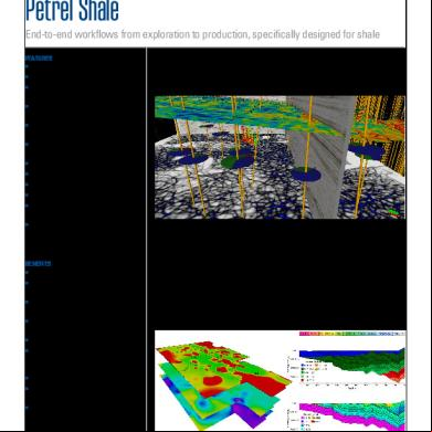
Petrel Shale 2l43q
January 2022 0
Manual Petrel 2s4t2b
December 2019 292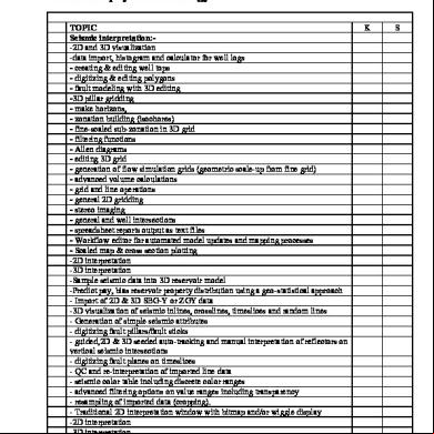
Petrel Geophysics 124h2a
November 2020 0
Petrel Tutorior 2x65r
November 2021 0More Documents from "Miguel Angel Catunta Zarate" 734d6f
Petrel English 56a3u
December 2019 71
2c82t
August 2020 0
Capitulo I Resumen Ejecutivo Dia Riqueza 4u5214
December 2020 0
Corrientes Literarias.pdf 6l6468
December 2019 41
Algebra Lineal Para Contadores 4s6z20
December 2022 0